End of Life — Legacy Version
Urbano v1 has reached end of life and is no longer actively maintained. This documentation is kept for reference only. We recommend using Urbano v2 for active projects.
Go to Urbano v2 Download DEM and Build Terrain Mesh
Download the DEM data and build the terrain mesh (Allow administrator access for Rhino; Wait until the download to be completed in the background and re-enable this component to see the changes)
Inputs
-
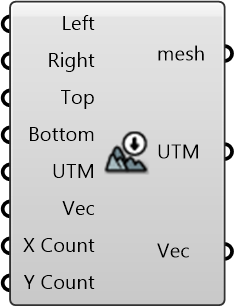
Left []
Left Bound (Longitude, x-axis) of the site -
Right []
Right Bound (Longitude, x-axis) of the site -
Top []
Top Bound (Latitude, y-axis) of the site -
Bottom []
Bottom Bound (Latitude, y-axis) of the site -
UTM []
UTM Zone of the given region (can be used along with translation vector) to transform data from different sources to a common origin) -
Vec []
Translation vector to move from actual UTM window to working origin (can be used to transform data from different sources to a common origin) -
X Count []
Count of mesh vertices on X axis -
Y Count []
Count of mesh vertices on Y axis
Outputs
-
mesh
Terrain mesh constructed based on the DEM data (data resource: USGS SRTM3 Dataset) -
UTM
UTM Zone of the given region (can be used along with translation vector) to transform data from different sources to a common origin) -
Vec
Translation vector to move from actual UTM window to working origin (can be used to transform data from different sources to a common origin)