 Deconstruct Boundary
Deconstruct Boundary
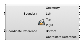
Input
-
Boundary [Text]
A string representing geographical boundary -
Coordinate Reference [CR]
Coordinate reference information for properly locating the geometries in the Rhino canvas
Output
-
Geometry [Curve]
Geometry -
Left [Number]
Minimum longitude, left boundary. -
Top [Number]
Maximum latitude, top boundary. -
Right [Number]
Maximum longitude, right boundary. -
Bottom [Number]
Minimum latitude, bottom boundary. -
Coordinate Reference [CR]
Coordinate reference information for properly locating the geometries in the Rhino canvas